Showing posts with label PUG. Show all posts

Monday, March 1, 2010

Using ArcGIS Explorer (900) for Presentations

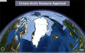
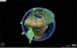
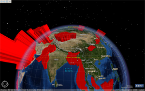
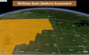
I recently had the opportunity to present at the 2010 ESRI Petroleum User's Group (PUG) meeting in Houston. My talk was nothing earth-shattering, basically just a intro/tour of the work our team had been doing the previous year. My time-slot was short, 25 minutes with 5 minutes of Q & A. This was fine with me. Given my short attention span and propensity towards ADD behaviors, I actually prefer quick talks. Faced with this and the fact that my talk didn't contain much factual information, I wanted to try something a bit different standard slides. Although I hadn't worked with ArcGIS Explorer (AGX) much, I remembered hearing the ability within build 900 to perform some short of slide show so thought I would give it a try. The global nature of the materials I wanted to present also lended itself nicely to this platform.


ArcGIS Explorer Build 900

The process to do this is was pretty simple. The workflow is basically to:
  1. Stylize layers in either ArcMap or ArcGlobe (for 3D stuff).
  2. Build an AGX project
  3. Navigate to various "views" and capture "slides"
  4. Place titles on "slides" if desired
  5. Activate the show by simply hitting the go button.
The Cool
  • Wow factor provided by the geobrowser platform, especially to non-geo audiences.
  • Super easy to do, very intuitive workflow.
  • From a presentation flow persepective, the platform allows for a nice, smooth talk with soft transitions.
  • Informative media, not a boring slide of text or some dopey picture from istock.
  • Features can be identified, both to the data layer's attribute table or hyperlink field
The Not Very Cool
  • Because it is so easy, it isn't very feature rich. Aside from being able to add titles, there really isn't any way to annotate your slides
  • It is pretty buggy. The identify functionality works about 90% of the time, guaranteed to not work when it really counts.
  • Identify only works on "data layers" but not references created by layer files. This is problematic because you need to use layer files for rich symbology (from ArcGlobe). The work around for this is to add the layer as a data layer, make it 100% transparent, then add it with the desired symbology (using the layer file) for viewing.
Results


Friday, February 27, 2009

What’s New in ArcGIS Server 9.3.1

I just returned from the ESRI Petroleum User’s Group (PUG) conference in Texas. The buzz this year was a little lower than those of an anticipated major release. The featured release during this gathering was 9.3.1. As I mentioned in a previous post, nary a word was mentioned regarding Desktop, it was all about “Web GIS.” Given my professional interest in this platform, this was ok with me. While many of the demos highlighted the various development platforms including the JS and FLEX API’s, a few included new features in 9.3.1. Probably the most anticipated, at least for AGS users, is increased performance for dynamic map serving. As far as I could tell, implementation of this new feature is actually done via a tool designed to help optimize the map document. The demo illustrating this improvement included a side-by-side comparison of the same dynamically generated map service, one that had been “optimized” using the new optimization tool and one that hadn’t. Each map display included a timer depicting load times. Anecdotally, map services which had been “optimized” using the new tool loaded about 3 times as fast. The optimization tool, utilized in ArcMap during the demo, looked at characteristics of the map document including whether the projection of the data frame matched that of the data, whether any data links were missing, scale dependent rendering, symbol level drawing and a couple of others that I missed. The workflow for tool use included an iterative process of optimization and map service preview. The demo was good and even generated a fair amount of applause. However, if faster dynamic map generation centers on checking the characteristics I listed above, don’t hold your breath. It seems to me that most folks are already looking at these sorts of things.


Other features mentioned but not demoed in the 9.3.1 release included the ability to publish to AGS directly from ArcMap and integration of Virtual Earth base data (not Google) directly into the ESRI platform including ArcMap. There was also some discussion about the new sharing framework via ArcGIS Online. While some may say “not another one” this one features content sharing and discovery definitely designed for a GIS pro and not so much for general consumers. Other notable discussions included AGX build 900 and the notion of what ESRI is calling a layer package (not sure if this is 9.3.1 or 9.4). The layer package is simply of was of packages data and cartography for sharing purposes.

Tuesday, February 24, 2009

2009 ESRI Petroleum User Group (PUG) Conference

Today is day two of the 2009 Petroleum User's Group conference. Yesterday featured the standard PUG fair including the usual ESRI plenary "dog and pony" show followed by some really good user presentations. Lead by Clint Brown, the tone of the plenary talks centered on "Web GIS." Highlights included ArcGIS 9.3.1 discussion, demos of the JS and FLEX APIs as well as some discussion about yet another sharing framework being designed via ArcGIS Online. To the dismay of a typically traditional GIS audience, it is clear that the focus of ESRI's R & D/future direction is "Web GIS." I'm not even sure if Desktop was even mentioned. The term "consumable" in the context of data and services was mentioned at least a dozen times with emphasis is user experience oriented towards the Google and VE patterns.